Are you looking for information on the best mountain bike trails in Peru and want to know where to ride? We surveyed various people who cycle in the Peruvian Andes, including MTB guides, local and foreign racers, and professional mountain bikers. We asked them what their favorite trails were and created a list of the 10 best mountain bike trails in Peru.
The Best 10 Mountain Bike Trails in Peru
“Written by a local cyclist, for cyclists around the world”
Wild and Rugged Mountains
Exploring the wild mountains of the Peruvian Andes by bike is an epic and transformative experience, full of fun and dreams. The endless rugged terrain, the fusion of mountains and jungle, the unparalleled flora and fauna, the terraced Inca slopes, and the ancient culture forgotten in time will leave a lasting impression on you. Whether you enjoy speed or prefer to admire the scenery on two wheels, the Andes are known for their world-class mountain biking trails, with natural gradients and ancient single-track paths that have connected remote villages since ancient times. With downhill and enduro trails, snow and sun, colorful potatoes, and locally brewed corn beer in abundance, Peru offers a natural paradise for adventure lovers and mountain bikers.

1. La Máxima Mountain Bike Trail in Peru’s Sacred Valley:
Voted the best mountain bike trail in Peru!

The results are impressive… our survey revealed that La Máxima is the best mountain bike trail in Peru!
La Máxima – Urquillos is a 15 km expert-level trail located in the Sacred Valley of the Incas. It will take you past stunning viewpoints of interconnected valleys and mountains. With an altitude of up to 4,000 m, the route will literally take your breath away, but it’s worth it. You begin the descent at 3,000 m along the route. The last 2 km are an intense descent full of tight, loose turns with rocks of varying sizes.
What you should know about this incredible mountain bike trail: The trailhead is locked, so it’s best to enlist the help of a local MTB agency or a friend to locate the key and the starting point. It’s easy to get lost on this trail, so it’s advisable not to ride it alone. It’s recommended to travel with a local company and familiarize yourself with other trails before venturing into La Máxima. After a rainstorm, the trail grip improves, but be careful as shuttles may have difficulty reaching the trailhead during or after heavy rain. La Máxima is located 2 hours from Cusco and 1 hour from Urubamba.
- Location: Sacred Valley of the Incas – Chinchero to Urquillos
- Skill Level: Intermediate/Advanced
- Distance: 17 km/11 miles
- Maximum Elevation: 4489 m/14,700 ft
- Descent: 1600 m/5240 ft
- Terrain: Varied with hard-packed soil, rock gardens, loose and steep rocks, and long, exposed traverses.
2. The Radar Trail in the South Valley: Peru’s Second Best MTB Trail

The Radar Trail has been rated the second best in Peru!
This trail gets its name from the large soccer-shaped ball at the trailhead, which is used to guide flights arriving in Cusco. Known locally as “rah-dar,” this narrow single-track trail offers stunning views of the Ausangate mountain range to the south before descending a steep ridge and quickly transforming into a more technical trail. With epic rock features and fun switchbacks, it’s ideal for thrill-seeking cyclists. Along the South Valley, you’ll enjoy fields of quinoa, wheat, and lush vegetation. At the end of the trail, you’ll follow a water channel that runs alongside the Vilcanota River and emerges near the village of Andahuaylillas, in a locality called Secsencalle.
This trail was discovered by Ramón “El Presidente” of the South Valley and Bill Koch of Haku Expeditions, who joined forces to connect two incredible mountain bike trails and create a unique and breathtaking mountain experience. Ramón provides annual trail maintenance with financial support from several agencies.
Some things to keep in mind when riding the MTB Radar Trail in Peru’s South Valley:
It’s easy to get lost on the trail, as many forks lead to local farms and adobe houses, where dogs can be aggressive toward visitors.
The trail begins in the aircraft radar zone, so it is recommended to avoid using drones near the area.
The narrow section near the Vilcanota River can be flooded during the heavy rainy season. Don’t miss Ben’s exciting crash in the water channel!
The trailhead is located about 2 hours from Cusco. Get ready for an exciting mountain bike adventure!
- Location: Cusco South Valley at the Aircraft Radar Center
- Skill Level: Intermediate/Advanced
- Distance: 15 km/10 miles
- Max Elevation: 4,468 m/14,658 ft
- Descent: 1,367 m/4,487 ft
- Terrain: A mix of hard-packed dirt, loose rock, exposed trails, technical stair sections and narrow paths along the river.
3. Lamay Valley MTB Trails: Voted among the top three trails in Peru

The Lamay Valley is an ideal destination for mountain biking enthusiasts. It boasts a wide variety of MTB trails, with the popular Lamay 1, 2, and 3 trails standing out. Lamay 1, the most iconic of all, begins in the Sapaccto pastures, located at 4,190 m (13,200 ft) above sea level. With a 1,240 m (3,900 ft) descent to Lamay, this trail offers diverse terrain that combines single-track sections with elements of Inca technology, including uneven and exposed stairs.
The other two classic trails, Lamay 2 and Lamay 3, also offer exciting rides featuring twisting Inca staircases and a great dose of adrenaline. Upon reaching Lamay, riders can enjoy a well-deserved break at the trendy café/bar La Basé, where they can enjoy craft beer and delicious food.
When hiking the Lamay trails in the Sacred Valley, it is recommended to:
book a guided tour, as the trails have multiple forks and it is easy to get lost.
The classic trails require a shuttle vehicle to reach the trailhead, while other trails in the area are also accessible from Lamay. For example, Lamay 2 begins at a lake near the village of Huama and has a gate that requires a special key, which can be obtained by contacting the local president.
Additionally, it is important to keep in mind that trail maintenance and support for the local community are essential, so it is recommended to contribute to the cost of riding a bicycle on the trail.
Although Lamay shares third place with the Brujo Trail, its wealth of trails and location make this valley a must-see destination for mountain biking enthusiasts.
The trailhead is approximately 1 hour and 30 minutes from Cusco.
- Location: Lamay Valley, located in Peru’s Sacred Valley.
- Skill Level: Intermediate Tech+
- Distance: 14 km/8.5 miles (Lamay 1)
- Max Elevation: 4,189 m/13,744 ft (Lamay 1)
- Descent: 1,239 m/4,068 ft (Lamay 1)
- Terrain: Hard-packed, grassy, rocky, flowy mixed with tech, thick stairs, exposed
4. El Brujo Enduro – Downhill Mountain Bike Trail: One of the best trails in Peru by far!

We’ve talked about mountain bike trails in the Sacred Valley and the Southern Valley. Now we’re approaching one of Peru’s most outstanding trails, located near the city of Cusco. The trail known as El Brujo is located on a ridge south of Cusco and gets its name from an imposing rock face resembling a witch carved naturally into it. This demanding enduro and downhill route is ideal for capturing images while riding along the ridgetop, enjoying views of the towering Andes and overlooking the city of Cusco. Although it’s one of the most challenging trails in Cusco, it rewards with picturesque stretches, steep climbs at high altitudes, rugged stairs, and steep slopes with breathtaking views.
Some considerations for enjoying the mountain biking experience in El Brujo, Cusco:
Unlike the previous trails, once you find the trailhead, you can likely follow it all the way to the city without losing your way. To reach the altitude of 4,266 m/13,866 ft above sea level where the trail begins, you will need a shuttle.
You can then choose to return to the city or hire a shuttle for another hike.
At the top, near the trailhead, you will find a temple-like structure.
From there, head northeast in the opposite direction from the temple to pick up the trail. This enduro and downhill trail is located in a fairly remote area.
If you get injured or disoriented, you are more likely to encounter pumas than other hikers.
Due to the remoteness of this trail, it is essential to be fully equipped with everything you need, such as rain gear, a Camelbak backpack with tools, a camera, etc., to hike.
Some options to combine with El Brujo are the Radar and El Pastor trails, or the local Cusco trails in the city center.
The trailhead is approximately 1 hour and 25 minutes from Cusco.
- Location: South of Cusco near San Jerónimo
- Skill Level: Advanced
- Distance: 8 km/5 miles of singletrack and a total of 14 km/9 miles if you drive down to the town below
- Max Elevation: 4,225 m/13,863 ft
- Descent: 805 m/2,642 ft of singletrack and a total of 1,020 m/3,340 ft to the town below
- Terrain: Gnarly, steep, rugged, some short technical climbs, exposed ridge line
5. Huchuy Qosqo MTB – Hiking route: One of the most amazing routes in the entire Cusco region!

Huchuy Qosqo could easily have been considered one of the best mountain bike trails in Peru, rivaling La Máxima; sadly, it is no longer permitted for mountain bikes.
When Brett Tippie, a professional cyclist and MTB legend, rode this trail in 2018, he commented, “Definitely one of the best mountain bike trails in the world!”
Although Brett hasn’t experienced La Máxima, his opinion carries weight as he has ridden mountain bike trails around the world as part of his work.
Although it’s no longer possible to hike the Huchuy Qosqo Inca Trail by bike, you can still explore it on foot, which is worth mentioning. This ancient Inca trail is accessed via a grueling and challenging climb from Chincheros, or by four-wheel drive from the village of Ccorao. Along the trail, you’ll encounter fast sections of the Inca Trail, followed by long, twisting, exposed Inca stairways. Finally, you’ll descend through a narrow canyon with stairs before reaching the ruins of Huchuy Qosqo, a mysterious site of the Inca Viracocha.
Important aspects about the Huchuy Qosqo trail:
It is only accessible on foot (and in the past by bicycle), so you’re likely to be alone, apart from the site’s caretakers.
The descent from Huchuy Qosqo into the valley can be done via Calca or Lamay, with the Lamay section being the most challenging, with narrow and exposed switchbacks.
Admission to the ruins costs around 15 soles.
Due to their remote location, it’s important to be prepared with everything you need for a full day on the mountain.
Occasionally, the Ministry of Culture may be present at the site to prevent access by mountain biking agencies and locals. It’s advisable not to risk your guide or local agency by taking you there.
It’s important to respect the rules and regulations to preserve the integrity of this valuable archaeological site and enjoy a safe mountain experience.
- Location: Huchuy Qosqo
- Skill Level: Advanced
- Distance: 21 km/13 miles
- Max Elevation: 4,317 m/14,163 ft
- Descent: 1,388 m/4,555 ft
- Terrain: Wide, fast double track, loose and exposed stair sections, switchbacks
6. Lares Mountain Bike Trail: 5th best mountain bike trail in Peru

Lares is a very well-preserved Inca Trail route that can still be explored by mountain bike. Don’t miss this opportunity! It’s a classic trail you shouldn’t miss and might be the first one you should ride if you’re planning several days of mountain biking in Peru. It’s an ideal warm-up for the rest of the trails, unless you decide to start with the steep freeride section at the top—that would be going too far! Most people start just below Lares Pass, where the Inca Trail begins, at an altitude of 4,220 m/13,850 ft. This trail is a long descent of 1,540 m/5,040 ft to the village of Calca. Along the way, you’ll pass by herds of alpacas, and the scenery at the beginning of the trail will make you feel like you’re in a scene from The Lord of the Rings.
Important things to know about riding the Lares Mountain Bike Route:
It’s a double-width Inca Trail, although it may look like a single trail.
At the summit, you’ll find many natural rocks and wall walks.
Minimal exposure, unless you decide to take the optional river route, which is more challenging.
You can complete the hike straight and quickly to Calca, or opt for the scenic route, which is longer and has some obstacles.
If you find the trailhead, you can follow it without getting lost all the way to Tottora.
The trailhead is 1:30 to 2 hours from Cusco.
It’s recommended to combine this trail with the Ankashmarca Trail in the same valley, or with the Lamay Trails in a nearby valley.
A support vehicle is required to reach the summit. However, public buses can be found in Calca that will take you to the village of Lares and can drop you off at the trailhead, with space to carry your bike inside or strap it to the roof.
- Location: Lares – Sacred Valley
- Ability Level: Very strong beginner (walking some sections) to advanced riders, fun for everyone.
- Distance: 18 km/11 miles
- Max Elevation: 4,220 m/13,847 ft Inca Trail Start (4,462 m/14,639 ft on the Freeride-Scree Course)
- Elevation Descent: 1,282 m/4,206 ft (1,536 m/5,039 ft from the Scree Course)
- Terrain: Double-width Inca tracks, followed by a narrow, technical, rocky, and loose canyon section. Optional river trail with skinny bikes and street vendors.
7. Apu Ausangate MTB Trail: The Best High-Altitude XC Trail Ride in Peru

This hiking/mountain biking trail is a 22 km/14 mile loop in the Ausangate region, with glaciers so close you can almost touch them, frozen glacial lakes that might tempt you to take a dip, and snow-capped peaks in every view. The trail descends to the village of Pacchanta, where you can head straight to the hot springs to relax and unwind after an epic day. This day of biking would be considered a high-altitude scenic hike. You’ll find this to be more of an experience than a simple day of descent and ascent. This ride requires quite a bit of high-altitude exertion and some hiking (hiring a porter can support the local economy). The scenery on this trail will leave you speechless. You’ll pass seven glacial lakes with colors like teal, turquoise, deep blue, azure blue, green, pink, and lime green! For the local Quechua people, Apu Ausangate is a sacred mountain.
What you should know about riding the Apu Ausangate Glacial Lake Circuit:
You must be acclimatized for this ride. Most of the time you will be above 4,200 m/14,000 ft.
We do not recommend doing the round trip in one day from Cusco due to the elevation.
The best way to do this trip is to spend one or two nights with locals, ride the 22 km circuit on the second day, enjoy the hot springs, sleep in a local home, and return to Radal the next day.
If you have the opportunity to enjoy a Pachamanca with a local alpaca farmer, you will have added culture, delicious food, and
Peruvian history to your incredible mountain biking trip.
The weather in this area can change at any time, so it is important to be prepared with rain gear, a coat, snacks, water, sunscreen, etc.
This is a perfect trip to take with a non-biking friend or family member. They can walk while you pedal!
- Location: Ausangate Mountain Range south of Cusco
- Ability level: Strong beginners to advanced riders. Not technical, but physically intense due to the altitude—at some point, you reach almost 16,000 feet!
- Maximum elevation: 5,210 m/15,900 ft
Distance: 22 km/14 miles - Terrain: High-altitude climbing, cross-country, with a quick descent to hot springs, mostly wide double track.
8. Olleros Mountain Bike Trail: The best mountain bike trail in the Lima region of Peru!

From the majestic Andes Mountains to the crystalline shores of the Pacific Ocean, this legendary mountain bike ride could be considered one of the longest descents on the planet. Get ready for the adventure of a lifetime with this exhilarating downhill ride that begins at an impressive altitude of 3,415 m/11,200 ft above sea level! You’ll descend to the golden beaches of the Pacific Ocean, where you can enjoy the waves and relax on the soft sand. And don’t forget to try a delicious fresh ceviche after this challenging workout.
Some things to keep in mind about the Olleros Trail mountain bike tour:
The trails here are wild, narrow, and steep, filled with bushes and a vertigo-inducing descent from the heights of the Andes to the sea.
The trailhead is a 4-hour drive from Lima. It’s easy to get lost in the trail’s many forks, so it’s best not to do it alone.
Conditions are desert-like and sunny, so don’t forget to wear sunscreen. Plan a full day for this challenge and leave early from Lima.
- Location: Santo Domingo, Lima
- Required skill level: Intermediate to advanced
- Maximum altitude reached: 3,415 m/11,200 ft
- Total distance: 51 km/31 mi
- Cumulative descent: 3,415 m/11,200 ft
- Diverse terrain: Varying altitude, rocky sections, sandy slopes, drop-offs, and streams
9. The Inca Avalanche Mountain Bike Trail: Voted among the top ten mountain bike trails in Peru

The Inca Avalanche MTB Trail has been recognized as one of the best mountain bike trails in Peru, voted number one by at least three expert cyclists. This trail is extremely popular with over 200 riders who gather once a year for the Inca Avalanche downhill race. Starting in Abra Málaga and ending in the town of Phiry, this challenging 1,524 m/5,000 ft downhill course is winding, wet, and steep. It’s easy to see why it has become a favorite among racers, with an intense race where 200 riders compete simultaneously over muddy and treacherous terrain.
Things to consider about the Inca Avalanche MTB Trail in Peru:
This trail crosses a busy road 16 times, with several steep and dangerous crossings.
It is recommended to have a guide to identify the crossings and be aware of the tricky sections. It’s ideal to combine this trail with Patacancha or Pumamarca, as they are nearby.
The trailhead is almost three hours from Cusco, and a support vehicle is required.
Some crossings lack bridges, adding an additional challenge to the route.
This trail is only maintained for the annual race in April.
- Location: Just outside Ollantaytambo.
- Skill level required: Advanced
- Distance: 14.3 km / 8.88 miles
- Max elevation: 4,308 m / 14,135 ft
- Elevation drop: 1,514 m / 4,970 ft
- Terrain: Scruffy, grassy, and muddy upper section, fast double track of the Inca Trail, steep drop-offs, loose rocks, and varied terrain.
10. Maras Salt Mines MTB Trail: Voted best beginner trail in Peru

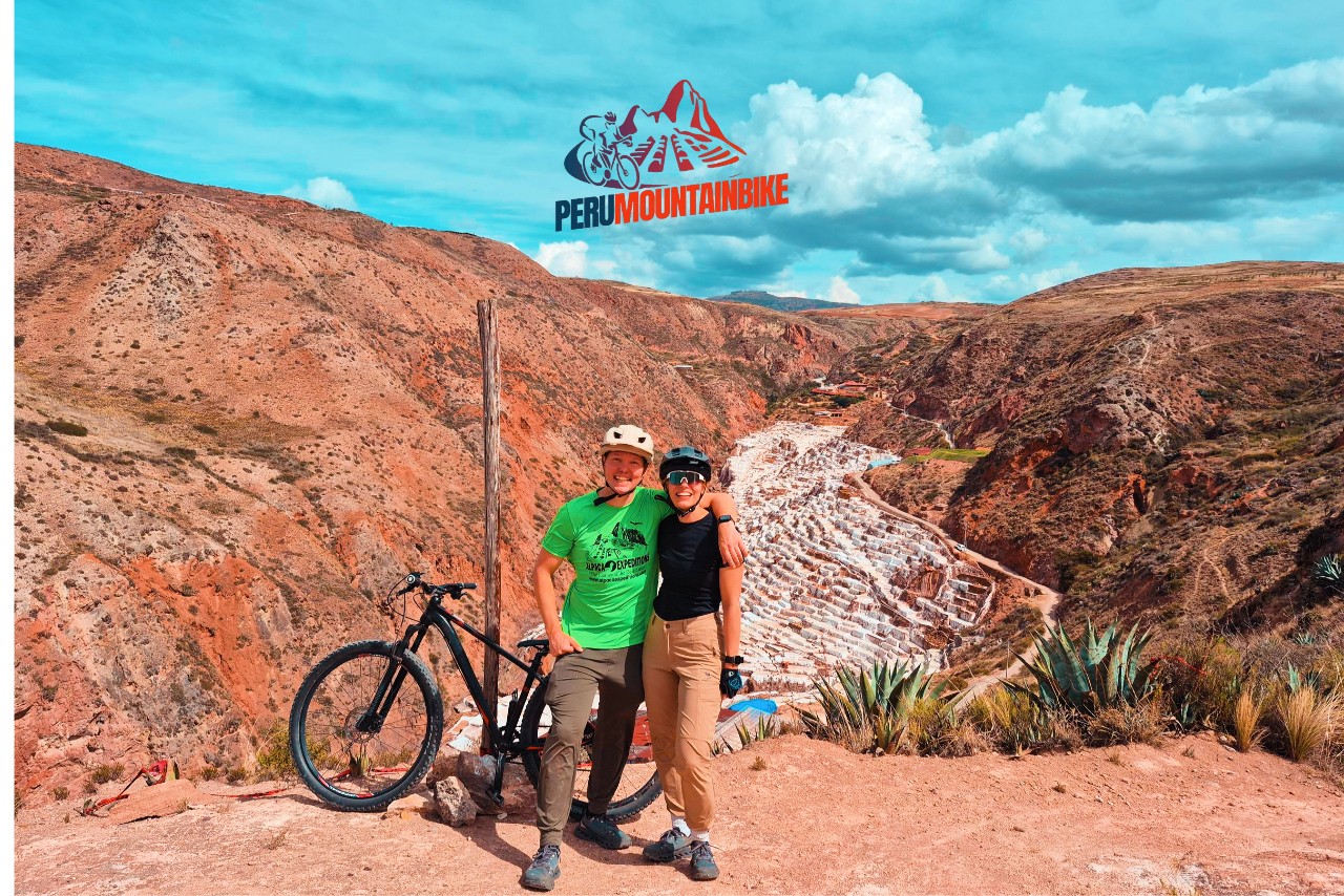
The Maras Mountain Bike Trail is a classic route found at most MTB operators. It’s the easiest trail in the entire Cusco region, according to our list of the best trails in Peru. While most trails in Peru are better suited for intermediate or advanced riders, this trail is perfect for beginners. It offers stunning views from the start, passing through Maras’ old town and salt pools, and then descending at high speed into the Sacred Valley.
Some details about the Maras Salt Mines MTB Trail:
This trail can be started at various locations near the town of Maras.
Some riders start at Cruz Pata to enjoy the panoramic views before descending into the Valley. Others prefer to start near the Moray ruins.
Those with a little more experience can start at Tres Cruces to add an additional technical section.
The Tres Cruces start offers two downhill options: an advanced DH track and another more suitable for intermediate riders. It is recommended to ride this trail on dry terrain or wait at least an hour after rain, as the ground can become clayey.
To visit the salt pools, an entrance fee of 15 to 20 soles is required.
The Tunupa restaurant is a good place to end the tour, with an excellent buffet lunch.
Although considered suitable for intermediate to beginner riders, this trail is perfect for cyclists who have been touring Peru for several days and are looking for a challenge that they can enjoy to the fullest.
- Location: Maras – Moray Zone
- Difficulty Level: Beginner-Intermediate
- Distance: 10.55 km/6.55 miles
- Maximum Elevation: 3,694 m/12,119 ft
- Descent: 857 m/2,811 ft
- Terrain: A mix of dirt roads and double-track trails, mostly gentle with some technical rocky switchbacks at the bottom.

How to explore one of Peru’s most impressive trails?
- Now that you know the best mountain biking trails in Peru, it’s important to plan how to get there.
- We recommend investing time and resources in finding a reliable mountain bike operator.
- This way, you can enjoy a day or several days of riding well-maintained trails, accompanied by expert guides who will take you along Peru’s most outstanding routes.